Coastal hydro[geo]dynamics
We monitor groundwater dynamics in coastal systems to understand how historic conditions can help us plan for extreme and future events. We want to contribute to the understanding of how groundwater contributes to coastal systems, processes, environments, and habitats.
Current projects
Sea-level rise hydrologic hazards
Current collaboration with the US Geological Survey developing numerical model-based forecasts of groundwater emergence and flooding hazards.
Project page: CoSMoS-GW
Research products
Our Coast, Our Future Interactive Flood Viewer for California:
ourcoastourfuture.org
Hazard Exposure Reporting and Analytics (HERA) tool:
usgs.gov/apps/hera
Geospatial water table depth data for California:
Available on ScienceBase.gov
Geospatial saline groundwater footprint data for California:
Available on HydroShare.org
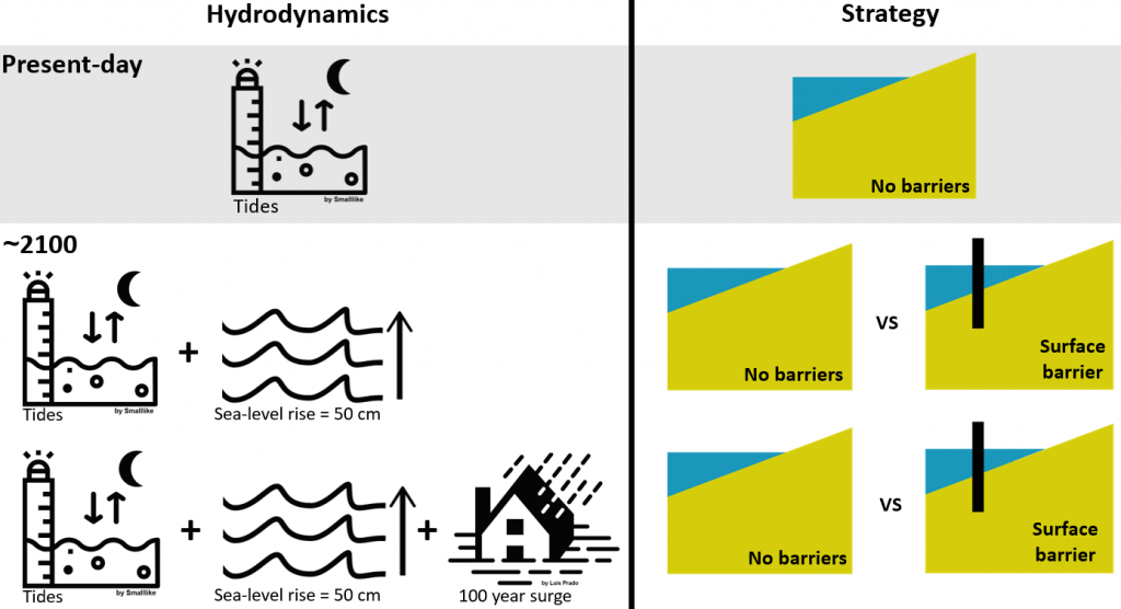
Combating combined flooding hazards
Current collaborative project funded by the NOAA EESLR program
Project page: Exploring ecosystem and community vulnerability to surface and subsurface flooding in California
Hydrologic feedbacks in diked wetlands
Current collaboration with the US Geological Survey, funded by the US Coastal Research Program, studying how the hydrologic conditions in diked estuaries will change in the future with sea-level rise and potential restoration efforts.